Závěrečná práce: Bc. Jonáš Rosecký, učo 485124: TerraTinker – Crafting Playful Visualizations from Geospatial Data
Diplomová práce
TerraTinker – Crafting Playful Visualizations from Geospatial Data
Anotace
Navzdory vysoké popularitě videoher a důležitosti vizualizací lze nalézt překvapivě málo výzkumů zabývajících se využitím videoher pro interaktivní vizualizace dat. Takový přístup kombinuje výhody interaktivních vizualizací s imerzivitou, kterou přinášejí seriózní hry. Cílem této práce bylo navrhnout a implementovat TerraTinker – nástroj, který transformuje geoprostorová data do interaktivních vizualizací …více
Abstract
Despite the popularity of video games and the importance of visualizations, surprisingly little research has been conducted on using video games for interactive data visualizations. Such approach seems to combine the benefits of interactive visualizations with the engagement brought by serious games. The objective of this thesis was to design and develop TerraTinker — a tool that transforms geospatial …více
Zadání práce
The objective of this thesis is to develop and implement a tool for transforming geospatial data into a virtual environment within the Minecraft video game. Initially, the student will conduct an analysis of existing solutions in this domain, upon which they will devise and execute the creation of a web-based application for the purpose of this playful geospatial data visualization. Additionally, the student will assess the suitability of Minecraft for this kind of data visualization.
The created tool will empower users to generate Minecraft maps utilizing data layers either sourced from OpenStreetMap or directly provided by the users. Notably, users will have the capability to customize the visual aspects of the generated map, including altering shapes and block materials.
The tool will be designed in close cooperation with the Craft-my-Street project team situated at University College Dublin, ensuring the tool's alignment with the project's objectives. One of the goals of this initiative is to provide resources for the public sector allowing them to create digital environments within Minecraft, fostering interaction among young individuals within the digital urban landscapes.
22. 5. 2024 16:29, RNDr. Vojtěch Brůža, učo 433392
Přílohy
docker-compose.yml
Source_code.zip
World_Saves.zip
Docker_Container_Images.zip
 angličtina
Konzultant
Práce na příbuzné téma
Seznam prací, které mají shodná klíčová slova.
-
Web application for visual analysis of geospatial information of natural ecosystems
Ing. Andrea Jonásová -
Web Application for Laboratory Data Analysis and Visualization
Mgr. Šimon Mačejovský -
Visualisation of data dependencies in relational databases
Ing. Petr Ivičič -
Methods for interactive analysis of Spatial Transcriptomics sequencing data
Mgr. Vojtěch Máčala -
Web application for structured capture of information supporting criminal investigations
Ing. Karolína Veselá -
Vizuální analýza záchytů síťových paketů
Mgr. Juraj Uhlár -
Computer Games Evidence Web-based Application
Bc. Eduard Štefan Mlynárik -
Finite Automata Design and Simulation Tool
Bc. Martin Tišš
Složky
Soubory
-
Přidání souboru
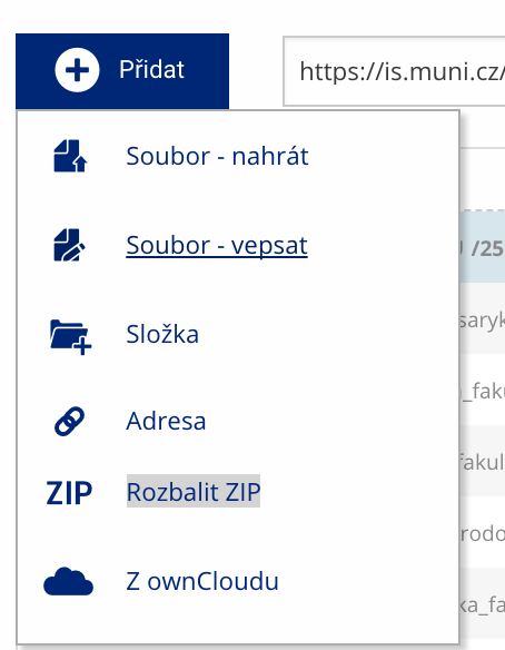 Soubor nebo složku lze nahrát pomocí tlačítka Přidat.
 -
Další operace se soubory
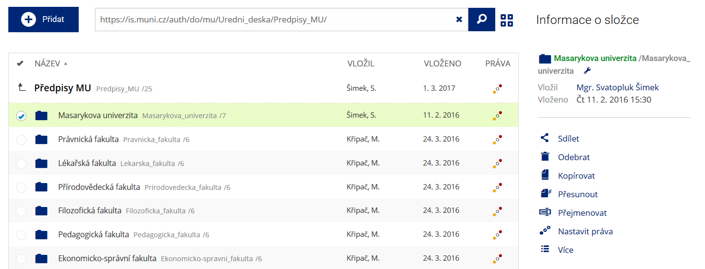 Podrobnosti lze zjistit označením příslušného řádku.
 -
Pohled pro experty
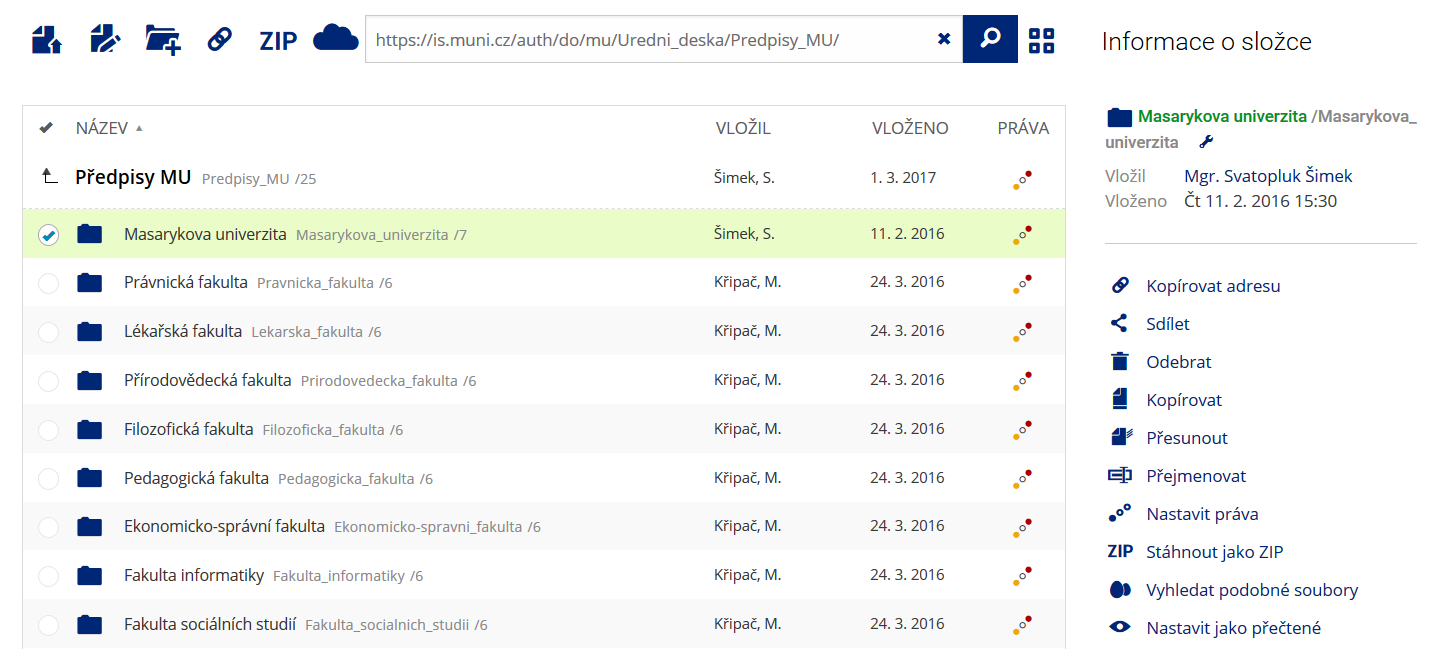 Pro častou práci je možné zvolit režim Více možností.
 -
Vyhledávání souborů
 Vyhledávaný výraz můžete zadat přímo do adresního řádku.
 -
Rychlý přístup k souborům
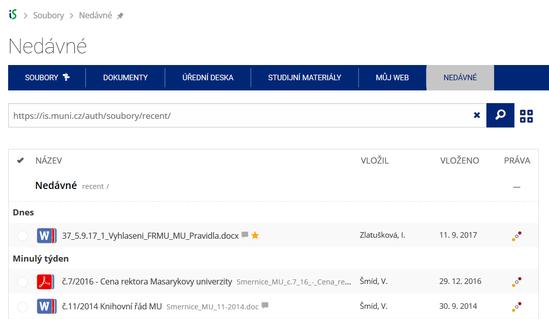 Pomocí funkce Nedávné je možné se rychle vrátit k právě prohlíženým souborům. Oblíbené soubory je také možné označit Hvězdičkou.